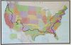
Nearly all of our travels are on the back roads – usually the smaller state highways, but sometimes just “such and so road.” With Google Maps and our DeLorme Map books for each state, we are able to find reliable backroads that we can actually traverse in the amazing blue bus.
The following maps show our route. Click any location icon and it will tell you where it was and when we were there. For the stalkers out there, you’ll have to stalk after-the-fact – sorry! Because Google doesn’t like the fact that we aren’t going the fastest (freeway) routes it chooses for us and then limits the number of “detours” we can take from it’s all-knowing “best route,” we’ve had to break it into several maps.
It takes too long to load the maps all one page now, so you can check them one-at-a-time:
2017 Las Vegas to New York
Once in Las Vegas we were planning to continue west, but plans changed, and we ended up heading back to New York.
2016-2017 Maine to Las Vegas
Having gone as far east (and north) as possible in the continental US, we headed back west, to get to the HSCG Conference in Las Vegas in May, 2017.
View the Map
2016 – Florida to Maine
Leaving Florida mid-May, driving up the coast and then spending most of August in Maine.
View the Map
Early 2016 – Florida and Georgia
At the start of 2016, we were at daughter Desi’s house in Clearwater, Florida. We stayed there until mid-March before heading out. Even so, we couldn’t travel too far away, because we had to be back in Tampa in May for the Handcrafted Soap and Cosmetic Guild‘s 2016 Annual Conference. So we spent 8 weeks working and moving about in Florida and Georgia (where it was a bit cooler than Tampa).
2015 – Oregon to Florida
We started out August 12, leaving the Oregon coast, heading north to the tip-top of Washington state. From there, it was 4,000 miles to Tampa, Florida, where we arrived just in time for Christmas.
View the Map